Second day

Our plan was to ride around the High Tatras (there is no road that would cross the central, steep and rocky area). Teresa's low fuel light had been on since the top of the Low Tatras (it came on at 387km/240.5mi), so I was a bit (not too much) worried not knowing the exact distance to overcome, but I trusted my calculations. Zakopane was quite close, after all.
So we got round the mountains from the South and East, now I know where we should have stopped (yes, it's still a huge problem for me to reconciliate riding and photography

), and reached the Polish border.

For some reason cars were queueing there, thankfully not in our direction... and when the queue ended we found a parking spot next to the serpentine road (practically a gazebo). It was full, of course; good that the bikes are so small.

Zakopane, our 'target' was awful. It might be a nice place, but it was crowded, teeming with tourists, showing the face of a busy city (while it's not a big town, really). Here we finally found a fuel station and filled up the bikes - it turned out that Teresa still had a lot of fuel to go (and Ciliegia had even more, not having 80km of commute and city trips back in Hungary).
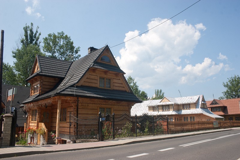
The main sight in Zakopane and the neighbouring tourist villages was the local architecture, the tricksy houses that sometimes consisted of many floors and full roof. I don't know how they're insulated, but I'm quite sure they need it, winters can be cold up there. Even the parking attendant's booth was built in this style.


We stayed in Poland till Chochol?w, took a little detour to a side street to eat a bit (we got food in a store where we were totally amused by the Polish texts - it's even more entertaining than Slovak village names

) and get our first sheep. It has the name 'Zakopane' embroidered on its side. The second we bought on the Slovak side, it has the name 'Vysok? Tatry'. They are our Shanghai and Hourai, in a sense (Touhou hint here, please ignore

).

Next place I found really beautiful was the West road of the High Tatras. It has the number 584 if anyone would like to find it. It leads among fields and less steep hills, then goes up to ~1100m/3600ft again, and is just as twisty as any such road there. Of course I missed the parking place on the top, so here are a few pics from 'down':


And on the way back to the campsite:


Tanks finished this day were:
Ciliegia: 424.7km (263.9mi), 11.91l (3.146 gal): 2.8l/100km (83.875 US MPG)
Teresa: 509.1km (316.34mi), 14.04l (3.709 gal): 2.76l/100km (85.29 US MPG)
Third day
The way home, almost the same route as forst day. We took a few more pics (many of the above were really shot this day). Road 537 on the South side of the mountains:


And the most mountains I could cover with a single shot, before the blue haze covered them:

The weather was hot when we left the mountains, especially when we arrived to Hungary in the afternoon. We haven't fueled the bikes again until the station closest to home.
The finishing tanks were:
Ciliegia: 521.2km (323.86mi), 13.78l (3.64 gal): 2.64l/100km (88.97 US MPG)
Teresa: 517.2km (321.37mi), 13.45l (3.553 gal): 2.6l/100km (90.45 US MPG)